
Coastal Explorer
Now on your Android and Apple Devices!
Coastal Explorer™ is a sophisticated, full-featured, easy-to-use navigation software package designed specifically for the pleasure boater.
With support for multiple chart formats, route planning features, integrated gazetteer and guide books, and virtual instrument display, Coastal Explorer will help you make your next cruise safer and more enjoyable.


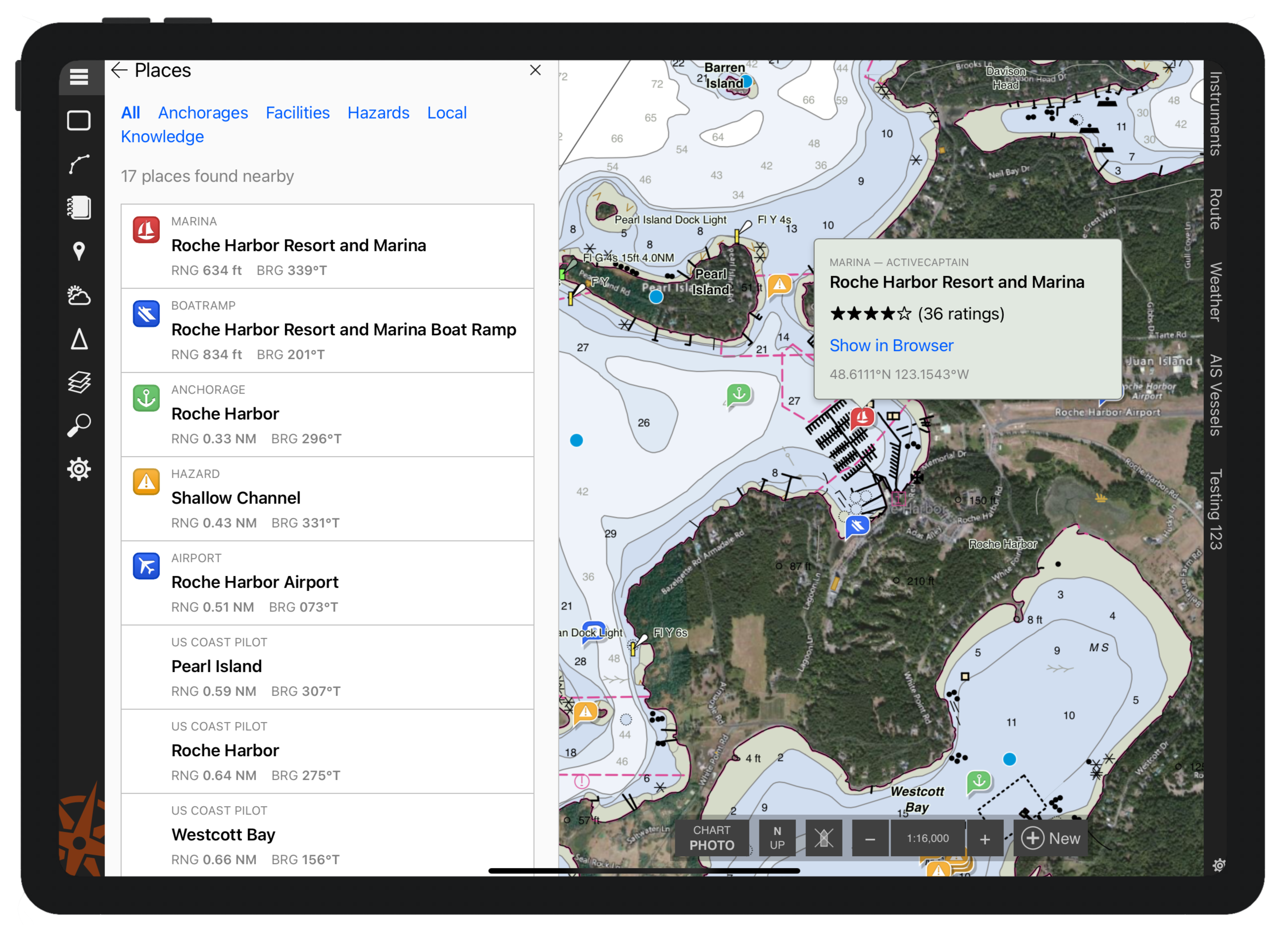
Explore
The gazetteer includes millions of places in the US, Canada, and many other countries. You can find any of these places on the chart by simply entering a name into the Search box!
Guidebook information from ActiveCaptain and other sources is tightly integrated into Coastal Explorer’s charts. Sailing directions from the US Coast Pilot® are also included.
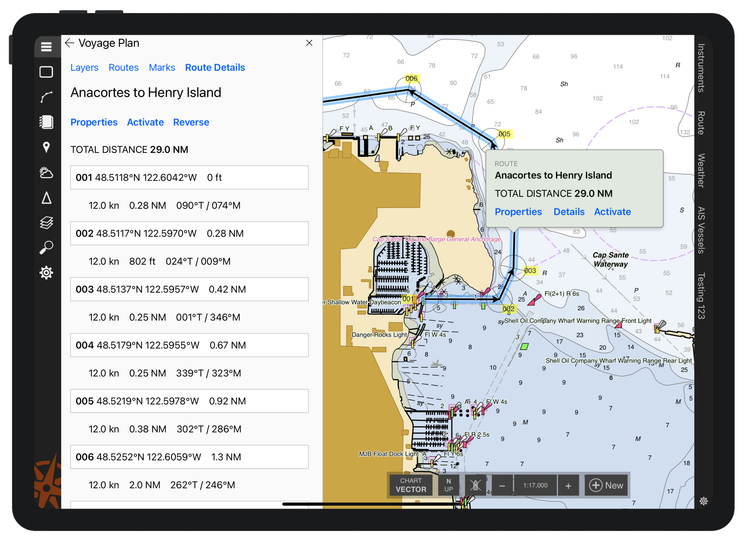
Plan
Coastal Explorer makes it easy to plan your next cruising adventure with unlimited routes and other marks.
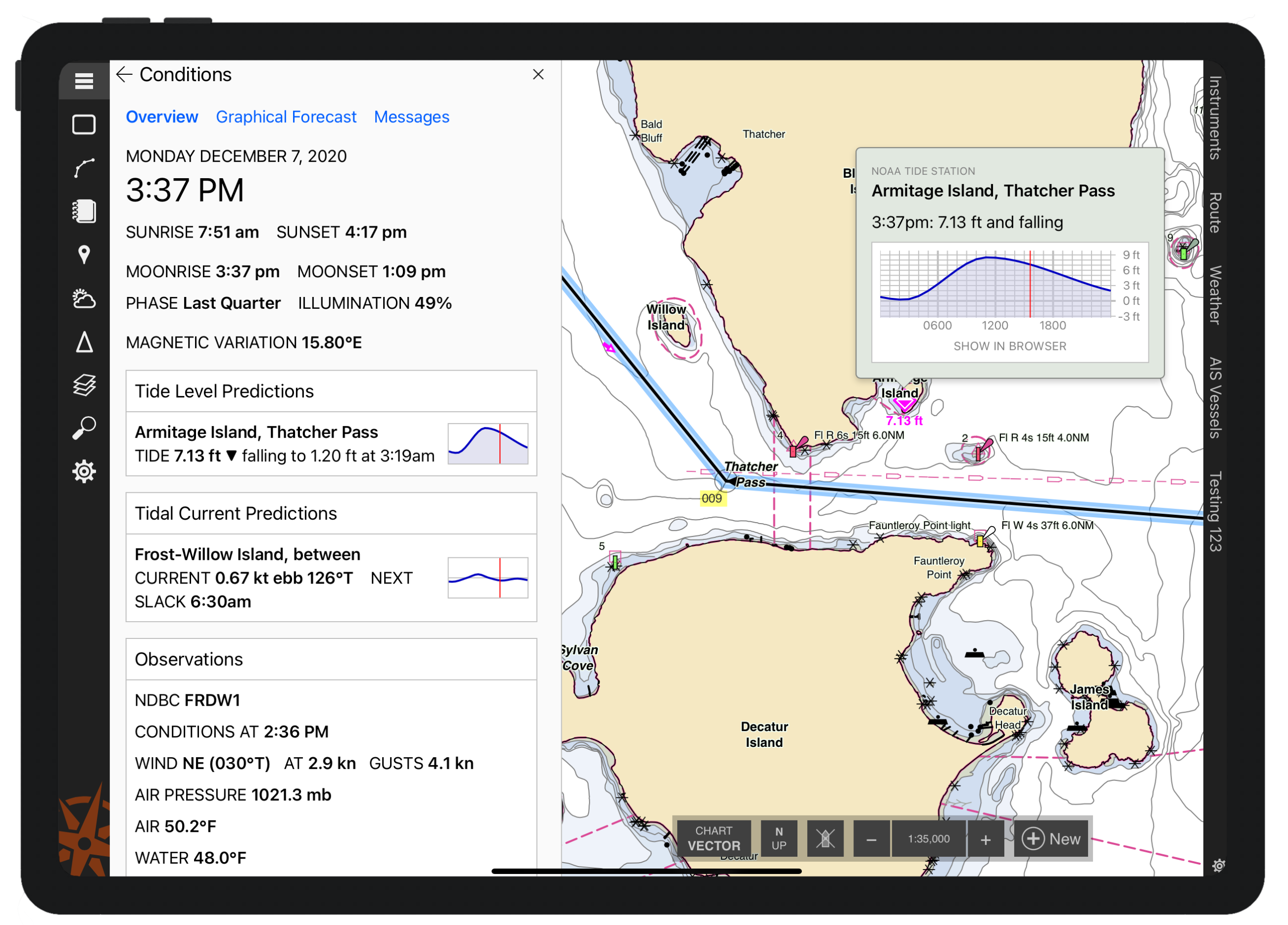
Prepare
Coastal Explorer can predict tide levels and tidal currents at all official US stations. Predictions for other countries are also available in some chart products. Tide predictions are presented in easy to read graphs along with daily high, low, and slack water times.
Weather forecasts are presented in various formats and are instantly available when you have internet access. Current weather conditions are also displayed when available.
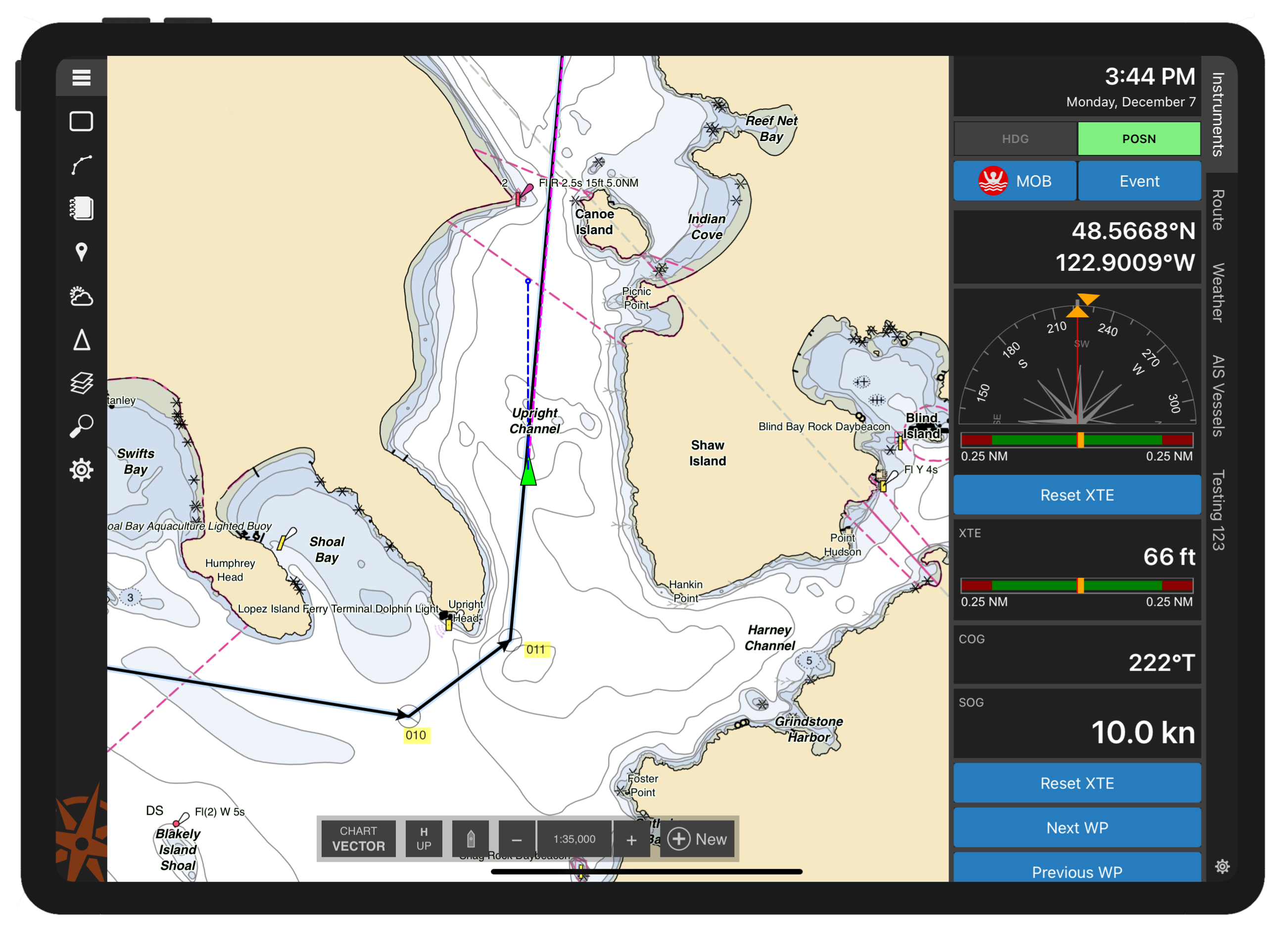
Navigate
(Chart Subscription Required)
With the purchase of a Chart Subscription, Coastal Explorer transforms from a planning and information tool to a complete navigation system!
Orient the chart with North Up, Heading Up, or Course Up and let Coastal Explorer automatically scroll the chart to keep your boat centered or near the edge so you can see more of what’s ahead.
Voice Alerts are used to warn you of waypoint arrivals, depths out of range, and other issues along your path!
Virtual Instrument panels show you information from your electronics in large, easy to see displays. Coastal Explorer includes an analog compass with waypoint arrow, analog wind, cross track error, and rudder angle displays, depth and temperature graphs, and many digital display options.
Remember
(Chart Subscription Required)
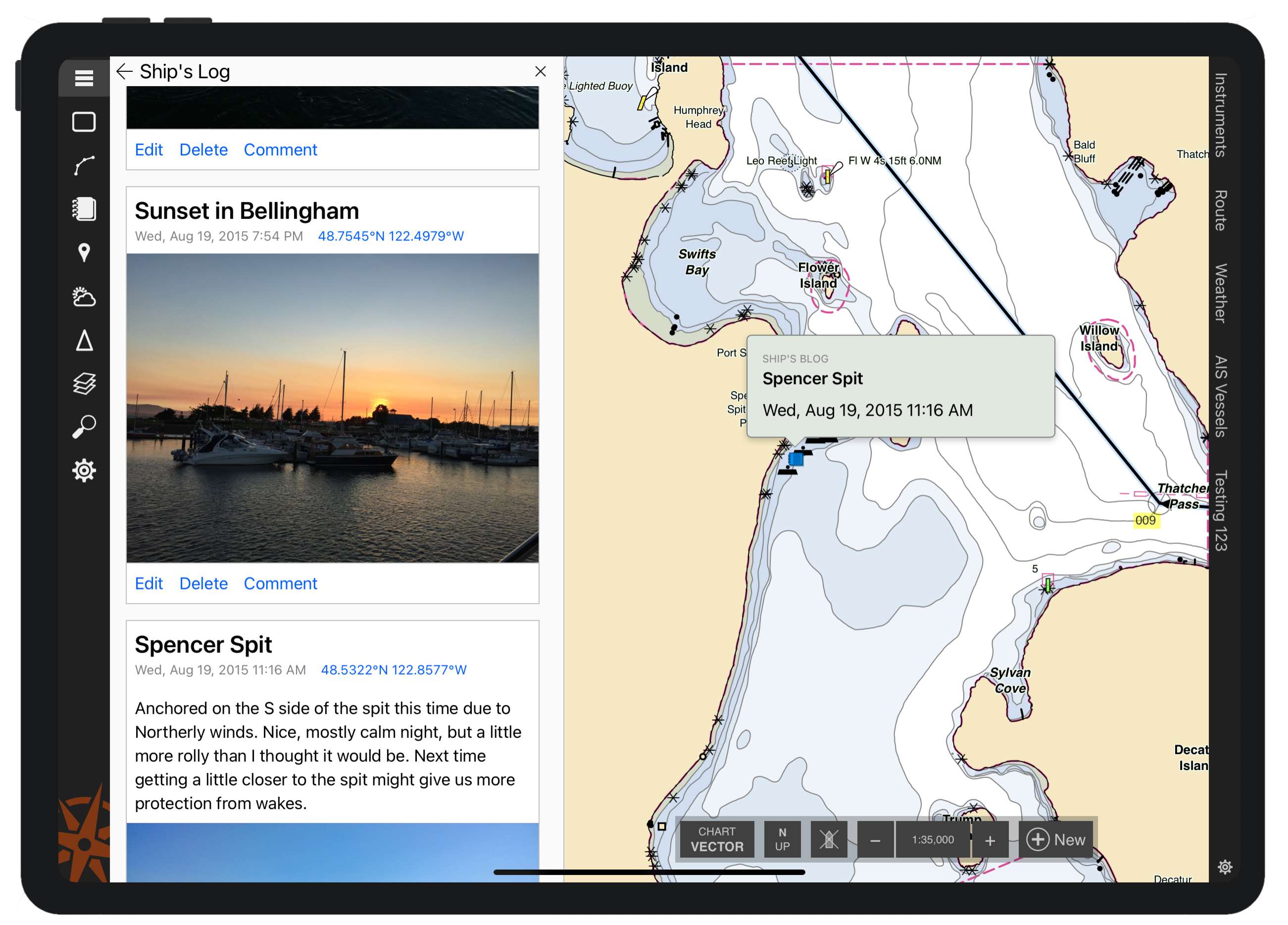
Use the Ship’s Log to keep track of your voyages and even share them with friends and family back home. Coastal Explorer provides you with three separate log books; one for notes, one that’s private, and one that you can share as a “blog” on the internet.
Interface Options
(Chart Subscription Required)
Coastal Explorer can use and display information from your GPS, heading sensor, depth sounder, autopilot, water speed and temperature sensors, wind and weather instruments, and AIS receiver. Our Nemo Gateway can interface Coastal Explorer with all of your NMEA 0183 and NMEA 2000® devices. Most other networked NMEA 0183 interfaces are supported as well.
Specifications
App Features
Device Compatibility
|
Chart Subscription Features
System Requirements
|